Rough planning
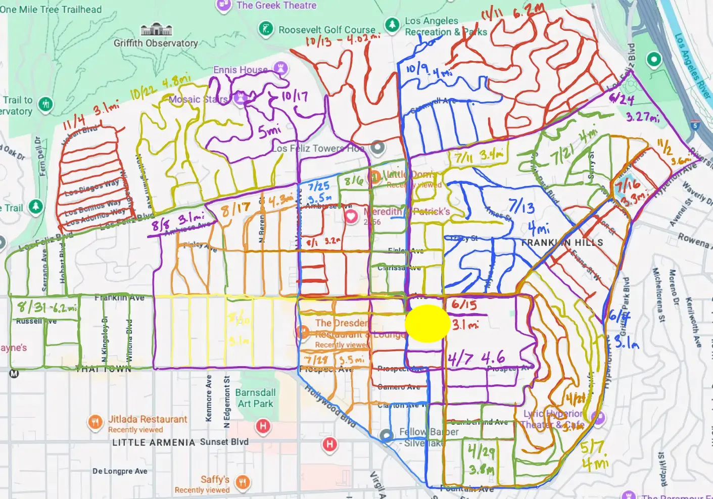
I didn't plan out my routes too exactly - I just tried to remember where I'd been and where I hadn't, generally tackling one NC district at a time, then drawing where I'd run on this map.
A needlessly thorough tour of my neighborhood
In 2024, I decided to run every street in Los Feliz and hike every trail in Griffith Park. In 2026, I created this site to map those runs.
See where I wentRecorded on Apple Watch
December 2024—November 2025
100.8 miles running the neighborhood, block by block
85.3 miles finishing every trail in Griffith Park
Chapter 01 · Running these streets
As a member of the Los Feliz Neighborhood Council, I thought it would be fun to see every street in the neighborhood. For about a year, every time I went for a run, I tried to explore a different area.
I didn't plan out my routes too exactly - I just tried to remember where I'd been and where I hadn't, generally tackling one NC district at a time, then drawing where I'd run on this map.
The blank spot on the map is a gated community called Laughlin Park. It's my white whale. I thought about sneaking in behind a Bentley to run the last few streets, but didn't want to get shot by Angelina Jolie's bodyguards. If you know someone who could get me access, let me know!
The complete record
If you're really that interested in my exercise habits, run data including pace, weather, heart rate, and other receipts for all 26 of my runs can be found below.
Open 26 runsRoute colors match the map. Select a run for its full route and details.
My temporary obsession, quantified
Across every outing
—
—
—
—
feet, one hill at a time
Chapter 02 · The park
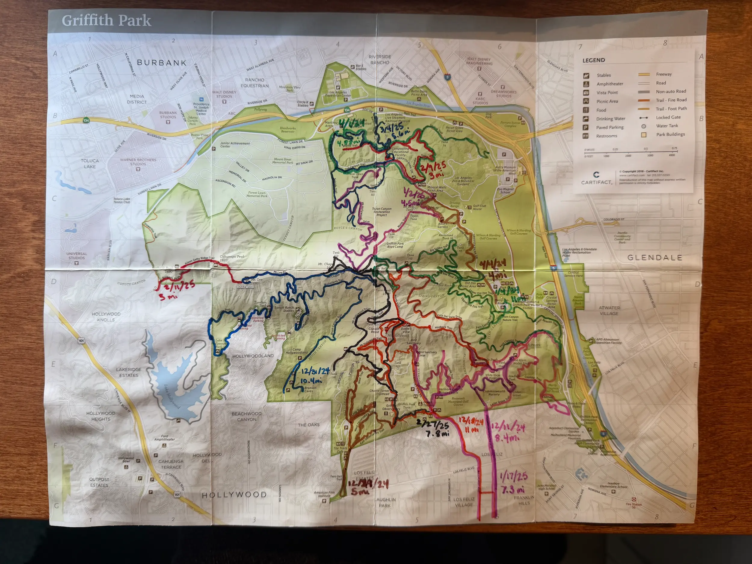
In between runs, I figured I'd try to complete every trail in Griffith Park. I did it in thirteen trips, marking my completed routes by hand on an official map.
Shortly after I finished, the Friends of Griffith Park released the very cool Griffith Park Explorer (GP-eX) program, which featured much more efficient routes than I took.
combined feet climbed
—
—
estimated across 13 hikes
The complete record
Thirteen hikes, including distance, climbing, pace, heart rate, weather, and some other numbers my watch saved.
Open 13 hikesColors match the map. Select a hike to isolate its route and elevation profile.
How it was made
I tracked each outing on an Apple Watch, then exported the route as a GPX file.
Distance and speed come from the GPX records. I manually added heart rate, calories burned, and other info that wasn't exported to a spreadsheet.
I assigned each run to the council district containing most of its route, and coded this site through dozens of prompts in ChatGPT Codex (writing all copy myself).
District outlines are an interpretive digitization of the official LFNC map and written boundaries, not an official GIS layer. Los Feliz’s outer boundary comes from the City of Los Angeles Geohub